Google Maps for bicycles is getting better and better. Not only is it possible to map bike routes but it is also possible to "see" new bike routes.
In addition, it's possible to choose a "map" view or a "terrain" view.
This works here and in France.
To try it, go to one of the embedded maps on this blog. I've chosen this one because it shows all of these features.
Before you go there, remember to keep in mind that you can click the "view larger map" just underneath the embedded map. When you do that, the route will open in Google Maps. Okay, head over there.
When Google Maps launches, you can see (depending on your device) information about the length of the ride and Google Maps' estimate of how long it will take. In this instance, the route is about 13 miles and will take a little over an hour and a half.
Look for "Options" or "Layers" if you are in an iOS device. There you should be able to check "terrain". That will give you something like a topo map.
In the same drop down box, check "bicycle." Now look at the route. You will see additional bike routes in the upper left corner and also down at the bottom. There are three types including dots for "bike friendly" roads. See if you can scope out the other two.
Again in the same drop down box, check "traffic." If there is congestion, that should show in red. (I haven't seen it yet, but it's now late at night in the Castlenaudry area.)
In the cycling Guidebook, this route to St-Ferreol Reservoir is described as "exposed." I'm going to check it for traffic and see if there is any congestion. If there is, then I'd start with the less-exposed route which you can examine here.
Happy exploring....
Friday, January 10, 2014
Thursday, January 9, 2014

Tuesday, January 7, 2014
Another General Overview
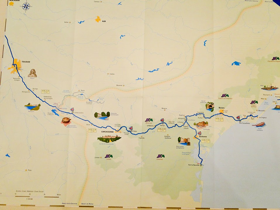 It's new territory, so it helps to be oriented. The overall route is shown at the top of the blog, just under the title (with three excursions). It appears in this map as well. Notice Toulouse on the left and our route east all the way to the Mediterranean. (A cropped version of this map appears here.)
Chart of Daily Progress
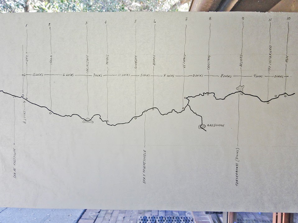 Our Captain John's careful plan for each day's progress along the Canal and through the Locks. (It is not written in stone. :))
Here is the spreadsheet version.
Excursion to Minerve
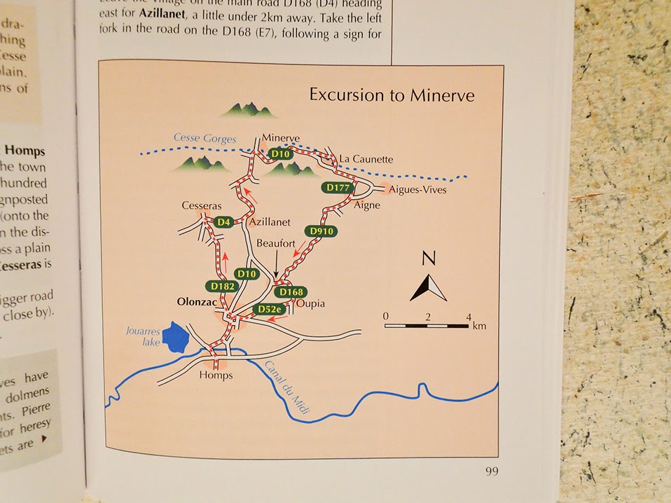 From the Cycling Guide. Also mapped here earlier. (Download-ready to your GPS.)

Rebenty Aquaduct: Sights near the Canal
 One of the many historical features of this National Heritage site.
Castlenaudry (General Area)
 More of an aerial view. (Again, see earlier posts for complementary views.)
Castlenaudry (Detail)


Map Overview
 We will have plenty of maps for the trip. This one shows an overview. Note we will go going from the left side of the map to the right through Beziers.
Subscribe to:
Posts (Atom)